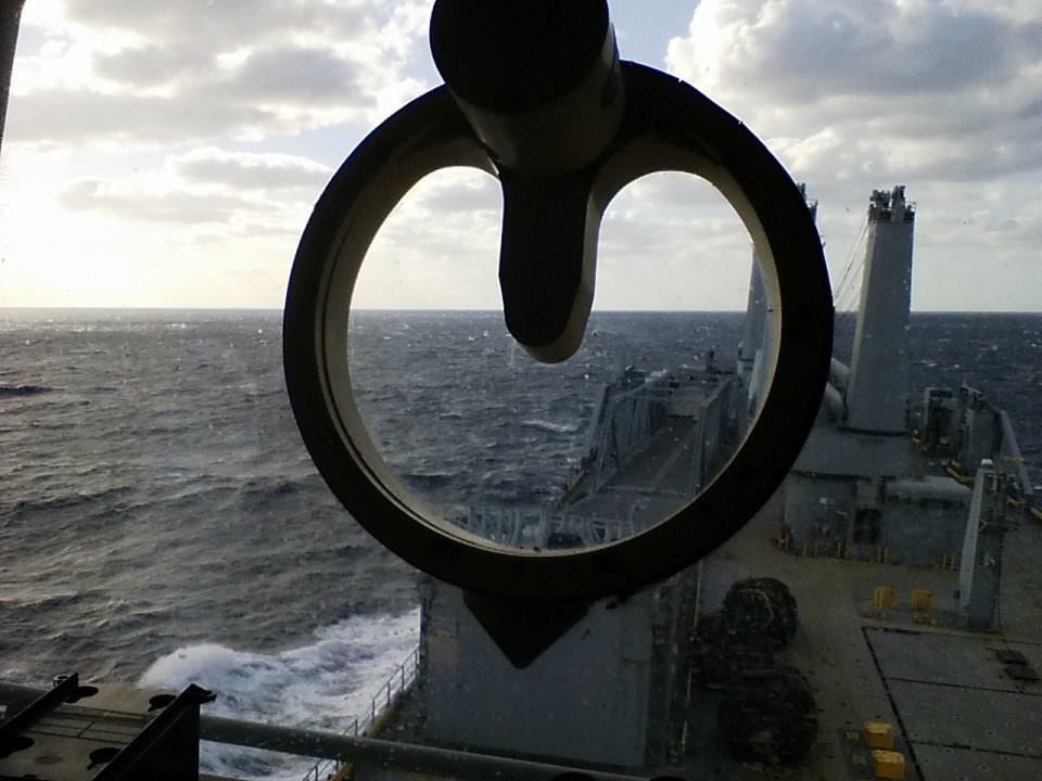
Charlie Sheldon studied at Yale University (American Studies) and the University of Massachusetts (Master’s Degree in Wildlife Biology and Resource Management). He then went to sea as a commercial fisherman off New England, fishing for cod, haddock, lobster, red crab, squid, and swordfish. Active in the fight for the 200-mile Fisheries Conservation Zone, he later worked as a consultant for Fishery Management Councils, developing fishery management plans and conducting gear development projects to develop more selective fisheries. He spent 28 years working for seaports (New York, Seattle, and Bellingham) as a project and construction manager and later as an executive. In addition to overseeing habitat cleanup projects, he worked with Puget Sound Tribes establish a system whereby tribal fishing could coexist with commercial shipping in Seattle Harbor and Elliot Bay. Then, nearly ancient, he returned to sea, shipping out with the Sailor’s Union of the Pacific as an Ordinary Seaman, Able Bodied Seaman, and Bosun. Starting with commercial container vessels, on the New York to Singapore run, he finished his career aboard naval ships for Military Sealift Command. His last gig was as bosun aboard USNS Shughart, New Orleans to New York, in 2016. Always a writer, he published Fat Chance with Felony and Mayhem Press in 2005. He began working on ideas for Strong Heart long, long ago and began serious research in 2010. These days he hikes in the Olympics whenever he can, cooks for his wife, and continues to write tales in Ballard, Washington.
When I was fishing on the East and Gulf Coasts a long time ago – actually a damn long time ago – there was a saying that wandered the docks. When boats tied up together in a port the guys working on the boats would talk to each other, on the dock or aboard boats or in the nearby barroom, catch up on scuttlebutt and gossip, tell lies. There was a phrase that floated around about some captains – actually at times more than some captains – and that phrase was, “He’s a screamer.” This meant that this person could not give an order without screaming the words, shouting, and often it seemed the case that no order was properly given unless it included at least two graphic insults.
There were of course more captains, usually many more captains, who were not screamers, they were level-headed men (and these days they include many women too) who had the crew’s respect, who rarely had to give orders because the crew knew what was expected and jumped to.
If you were lucky enough to be on a boat with a “good captain, meaning, someone who was all right to work for, this usually meant you were also on a boat that was well maintained, that carried the proper survival gear, where things usually worked, and where you made money. The crew members often became friends. I can name many boats which were based in New Bedford which had the same crew for two or three decades, they fished together, hunted deer together, and their captains, I am almost sure, were never screamers.
I worked for both types, and let me tell you, working for a screamer was dangerous, difficult, and downright scary at timers. The biggest issue was that screamers could not keep crew, they either fired those they did not like or drove the crew away, which meant that those of us who remained had to work twice as hard training the new guys every trip as well as doing the work. Boats with screamers in the wheelhouse gathered foc’sle lawyers down below, and disgruntled complainers, and laggards and bums.
I always figured the good captains remembered where they came from, how hard it was to learn the ropes, and had the good sense to admit when they didn’t know something, and were unafraid to ask. The good captains explained what was needed and gave others the respect to get it done, and in my experience if you treat someone as if they will do the job well, they usually do, whereas if you hover and pester the result is terrible.
The good captains were humble. They knew they did not know everything. They honored the weather and the force of the ocean. They supported the others around them and the others around them supported them. They went to work and brought back fish and an income, and they did it without breaking the crew.
Screamers? Never humble. Always trying to be on top, and better than. Never listen. Shout and scream and get angry easily. Have these ideas they have come up with which they declare must be true and refuse to admit they make no sense.
“Watch out for him, he’s a screamer.”
It feels, these days, the screamers gave taken over damn near everything, shouting their point of view and beliefs everywhere, insulting others, not listening, and most of all not learning or facing facts. Wouldn’t it be nice to have someone in the wheelhouse who assumed everyone on the boat was equally intent on making an income and coming home safe. That’s the case, or was, in the fishing industry, anyway.
It seems to me that the reason it feels like we have screamers everywhere – in politics, in the media, on school playgrounds – must have something to do with forgetting that we cannot have a community unless people listen and speak carefully, meaning, are humble with themselves and others. At sea, in the microcosm world that was limited to the boat, a screamer was toxic, dangerous, and inflected the entire world. In ancient times such a person was driven from the tribe, shunned, left to wander alone. Maybe we could use a little more of that now, because with all the screaming going on, people lose sight of what they don’t know, what they need too learn, and what they should be doing to keep the community strong.
From November 2022: I’m still out here on the north side of the Olympic Peninsula and the Strait of Juan de Fuca. That container ship that was burning sits about 20 miles from me, north, across the strait, near Victoria, fire now contained, perhaps even out. That monster storm that came through was a big one but no catastrophe, and it seems whatever struck all those waiting ships off California did not blow them all onto shore. There is snow in the higher elevations, creeping lower and lower as the air cools.. There has been a lot of rain. This has been, in fact, a fairly typical last week of October weather pattern for these parts.
We’ve been staying in a cabin not far from the Elwha River, maybe 10 miles west of Port Angeles, way up an old road near the end, among scattered houses, fields, trees, hard next to National Forest land and the national park. The other day the local herd of Roosevelt Elk, over 40 animals, wandered into the field behind this place and visited for an afternoon. They were magnificent.
This area, off Highway 101, just west of the river, was once called Elwha, one of the many forgotten local towns settled by pioneers before 1900. The little schoolhouse, built in 1908, still stands, now a community center. There is a long history of some local families here, written one Alice Alexander, grand daughter of a woman born on the homestead in the early 1890s who lived to 95, about her ancestors who came to this country when it was the remote end of civilization, to build homesteads, then houses, then a community. I am certain many of the homes out here are still owned by descendants of these families, great and great-great grandchildren of those pioneers.
The Olympic Peninsula in Washington State was one of the last settled regions in all of the continental United States. While there is absolutely no doubt in my mind that the native people here knew every inch of the entire peninsula, tree and trail, including the rugged and difficult to reach interior, the river headwaters and mountains were not properly mapped and surveyed until the late 1890s. This peninsula contains many recognized tribes of First Peoples, all with treaty fishing and hunting rights, and their presence and culture here is clear. On several roads leading to trailheads in the national park you will still pass cabins of huge logs, without roofs, 12 to 16 feet square, original homes of the original homesteaders.
Some of the greatest stands of timber in all the world grow here, and logging was the original and basic industry. My father worked in the logging woods in 1935-36 and he came to love the work and this area, which may be why I moved this way myself in 1990. The land, years ago, was a federal forest, and early on some people argued for its preservation while others argued for its exploitation. The easiest to reach timber stands, the lowlands, were huge, just enormous, but demand for lumber was steady and strong.
There is this story of how Olympic National Park came to be. It might be true. It is said that in 1938 timber barons convinced the President, Franklin Roosevelt, to come visit the peninsula, and they took him on a tour to convince him to open the rest of the federal land to logging. Roosevelt, arriving and seeing the grandeur of the country, instead made it a national park, a park that has grown in the decades since with newer adjacent wilderness areas. But logging continues, some stands of trees now logged and regrown three or four times.
Back in the earliest years of the 20th century, when the first settlers were building that school for their kids, the best way to get from Port Angeles to Seattle was by taking the steam packet, or ferry. That was a lot faster than walking or taking a horse drawn wagon on the terrible roads, over 100 miles, or trying to drive those roads in the newly invented motorcar.
But we humans are industrious, creative, and energetic. Maybe the interior of the peninsula was still uncharted in 1895, but by 1920, a quarter century later, there were roads all around the peninsula, trails all through the soon-to-become park, and lumber mills everywhere.
Now, a century later, nearly every single one of those dozens of lumber mills is no more, closed, removed, taken away. The dozens of salmon plants that once lined Puget Sound’s shores are gone. Almost every single original settler cabin has rotted away, been covered by other homes, or parking lots. Here at the foot of the road this cabin is on, downhill by Indian Creek, there is second growth forest, big tall trees, and no sign whatever of the shingle mills and lumber mills once there. One of the people who lived in this little community in 1905 or thereabouts, according to the family history here, was hunting up the Elwha River and a tributary and came upon some hot springs. (I suspect the truth is the First Peoples knew about these springs and told him.) He cut a trail, got some pack animals, and began ferrying people up to soak in those springs. Then he built, up there – this was at least 12 miles from this community, uphill all the way – a building to take customers, and later more buildings. There was an Olympic Hot Springs Resort and he made a business taking people up there to soak in the pools.
In the 1920s a second dam was built on the Elwha (the first was built downstream in about 1913) to power the local city and mills, and to build that dam a road was built and this road then carried on to those hot springs, a dirt road which still exists. By the late 1930s there were three buildings up there, cookhouses, sleeping rooms, maintenance sheds, the works. But then the business began to fade, and by 1940 the place closed, by then located within the borders of the national park, so some time after 1940 the park people removed all the buildings and everything else. I have been through that area a few times, and while there is still a dirt road leading to the pools, there is no evidence whatever of any resort, none. The pools are still hot, and used, but since the Elwha River washed out the access road only three miles from Route 101 there is no way to drive to the trailhead to the springs any longer, or, for that matter, other trailheads once accessed by roads.
The reason for the road washout? Both those dams, which by the way stopped salmon migration within six miles of the 50-mile river’s mouth, a salmon run that featured 100 pound king salmon, were closed in the 1970s and 1980s and then removed, with the last dam gone in 2014 or so. This was the biggest dam removal project in United States history. The removed dams swept millions of yards of sediment downstream and the river bed shifted and shifted again and cut off the access road, and a repair is barely in sight.
And that pack trail used years ago to get to the hot springs? It is now called the West Elwha Trail and still exists, I and my wife have hiked it many times, but now it only leads to the road that was later built, maybe five miles in.
All of which to say, in just the 130 years since this land was first opened, or settled by non-native people, most of the ancient forest has been cut down but then regrown (except for the heart of the peninsula where the million acre park lies, which is still pristine), two dams have been built and then removed (and the big salmon seem to be coming back), all evidence of dozens of lumber mills and resorts has been removed, there still exists a local economy based on some logging and services and recreation to the national park and surrounding areas, but things are tough, out this way, just as they seem tough in all out of the way places.
But – and this may be important – all those years ago when all that work and building was done, people fed themselves with local crops, used local materials for construction, made do with whatever they had, and, living in country they loved, appreciated what they were given and refused to complain about what they were missing. Maybe they did this because this was all they knew.
I am pretty sure, faced with our modern circumstance of hysteria imagining a delay or, God forbid, no shipment of items for the Christmas season, they would look at each other and smile before heading out back to start making toys…
My dad was a serious hunter and camper. He was in the 10th Mountain Division during World War II, he called them the “ski troops” but then they invaded Italy and fought all the way to Germany and war’s end without donning a ski once, and when my sister and I were little kids we were camping in the back yard all the time, using gear he had brought back from the war or a tent his father had used years earlier. When I grew older I had a best friend older than me, Doug Bysiewski, and we would go down back into the fields and forests behind our house and pitch a tent and stay over night, as often as we could, exploring, finding owl nests, poking snapping turtles, messing around the UMass dump, and of course smoking. Once when I was about 10 or 11 there was a huge rainstorm and the tiny creek beside our house which drained into a wide swamp past the corn field, where Doug and I trapped muskrats every winter, flooded, enormously, such that the swamp was flooded, too, reaching all the way to our back yard, so my dad took the little 13 foot cedar canoe his dad, the serious hunter in our family, had built in the 1920s, and Doug and I took the 12 foot Old Town we had, and we pushed off from our back yard and followed the flooded rivers all the way to the Connecticut River ten miles away, passing over fences and losing the channel, wandering through forests, beneath trees. It was a great adventure.
There was nothing to do in Amherst during the summer. Nothing. We kids got into trouble because what else was there to do? UMass was expanding with all these new buildings being built, a gold mine for mischief, rummaging through half built buildings, stealing smudge pots – remember them? – riding our bikes all over hell and gone, seeking excitement. We couldn’t go to work picking tobacco or cucumbers until we were 14, and when the colleges let out Amherst became a ghost town, so Doug and I camped out a lot. My dad taught us how to use an ax, build a fire, make a splint for broken bones, rig a temporary shelter, and the scoutmaster for North Amherst, a great guy, took us troops camping all the time too, on Mount Toby, where one night I woke up to find a porcupine inside the tent.
Back then, before Eastern Mountain Sports or REI, nobody did this, not really, except idiots or kids whose dads had been campers, too, and there didn’t seem to be many of them. I started using my dad’s Army mummy bag when I was 11 and used it through graduate school, it weighed a ton but was warmer than anything. He had these rubber boots, insulated, which I later used winter climbing in New Hampshire in 30 below weather and my feet stayed warm, also Army issue.
In the summer I was 12 I was sent to this camp near Mount Monadnock to get me out of the house and home town trouble, of which I was much drawn to. I carried with me all this old gear, because at this camp we ended the season with a two week long camping trip. It was the main and to me only attraction of the place, otherwise filled with pre-Ivy league boys from New Canaan and Shaker Heights and Greenwich, but it was actually an OK place. You could shoot a .22, which my dad had taught me well, chop wood, navigate with a map in the woods, which were all good, but every Friday we had greasy fish sticks and dead white mashed potatoes and stewed tomatoes for lunch and we had to eat it, meaning, every Friday afternoon I got sick.
Eventually the Great Day came when we embarked on our Long camping Trip, which involved an 11 hour drive from New Hampshire all the way to Baxter State Park in Maine, this in an era before the Interstate Highways had been built. We took a huge trailer with canoes and gear and packs and supplies, including the newly invented and marketed dehydrated foods by Bolton, in cardboard boxes. The latest thing, these foods. We split into two groups, and one group paddled about 40 miles of the Penobscot River near Mt. Kathadin and the other group climbed the mountain, and then we switched places. There was some kind of campsite by a bridge over the river we used as our base camp.
The first night out we didn’t make it to the site and had to camp off the road near Millinockett, Maine, hundreds of yards from a huge stinking pulp mill, this was early August, a heat wave, and all of us sweating in our bags breathing in the pulp stink while mosquitoes the size of humming birds devoured us. Remember I was in my dad’s war mummy bag, frying.
The trip was, in memory, great fun, and an adventure, but we had our issues. The river channel was blocked by log jams and we had to beat portages through thick brush for over a mile a few times to get downstream, and there were rapids a little too large for safety, and I don’t think any of the counselors, who were just college kids, knew what they were doing. On the mountain, it rained and blew, but the mountain is dramatic. One year, the second year I went to that camp before finally turning 14 and being able to work and make some money on the farms, we took a bush whack route up Kathadin, from a side with no trails, and that was something.
Back then, there were no 10 essentials, people made fires wherever, you’d find piles of tin cans everywhere you camped, few people were in the woods, and you’d see cigarette butts everywhere.
However, that first year, and the second, too, one thing nearly ruined the entire trip. It was this dehydrated food. The meat was horrible, and the noodles never got soft, everything tasted of plastic and glue, and there was never enough. The premier feature of this food was the Bolton Biscuits, which were these hard scone-shaped biscuits you’d break your teeth against. The second year I prepared for this experience. I packed a full can of Dirty Moore beef stew and I carried that, hidden, all through the trip, every day nursing along one Milky Way Bar for 10 days, and in the 10th and last day, the last night out, I broke out the can of stew and shared it with two other boys at a separate fire. The stew lasted all of four bites each. It was fantastic.
On the way back from those trips, all of us filthy, clothing horrible, we’d get outside the State Park on the way to Millinockett and the long way home and there was a Dairy Queen there and we’d stop and each of us get an enormous cone of smoothie ice cream, twirled into a peak. My God but that ice cream was good.
Up high – that is, above the thick forests – the terrain in the Olympics is entirely different. Up high lie meadows filled with grasses and clumps of trees, or acres of broken shale and flowers, rocks and cliffs, broad basins that lie open below the sky. These areas, usually above 4000 to 5000 feet, lie beneath snow for months of the year. The first snows fall in late October to mid-November and linger until late May in the lower areas and as late as August higher. There are places where the snows fail to melt for years at a time. This means that the open meadows and streams and tarns and lakes lie open to the sun and warmth for at most five months a year, and usually much less than that. The alpine growing season is probably 100 to 140 days a year, and in that time everything has to take place – the seeding, growing, flowering, turning. There is a little tarn on the way in to Grand Valley, just before or after the seasonal ranger tent, about the size of a bedroom, less than a foot deep, within which frogs breed, casts eggs, the eggs hatch, tadpoles form, and then the tadpoles become frogs, all within that 120 day window, all of it, such that the frogs are old enough to find a place to bury themselves and survive the long long winter. That little tarn always had frogs in it through out the 1990s and 2000s, then in about 2016 when I got back up there after a few years away at sea that tarn was barren, dry, bare earth, without frogs, but a couple of years later there water was back and so were the frogs. It is hard to guess the biological energy that must flow up in those alpine areas, all that growing and breeding and nurturing and then dying, happening so fast. Surely the flux must equal that of a rain forest, at least during those days of high sun, warmth, and growth. But the alpine areas are fragile, too, the topsoil thin, the roots holding plants to the soil somewhat fragile. The plants and roots are strong enough to withstand the weight of the snows, and the passage of avalanches in the spring, although trees are torn free and tumbled, and in many of the meadows the marmot populations dig burrows and alter the earth and cast aside soil, such that anyone walking across such a meadow must be careful lest they step into a deep hole. The elk go high in the summer, very high, living in those basins and meadows, and they have done so as long as elk have lived in this land, returning again and again to known areas and haunts, and, being heavy animals, tracking game trails across meadows and basins, some trails wide and over the aeons pounded deep into the earth, as much as six inches or a foot. There is evidence the first peoples who lived on the Olympic Peninsula wandered the high country as long as 7,000 years ago, and possibly much much longer. The oldest confirmed site with evidence of hunting in the Americas, a spear point embedded in a mastodon bone, was found in a Sequim prairie below the foothills of the northern Olympics, dated to 13,800 years ago. There are dozens of areas in the Park that are ancient, remote camps and sheltering places, used by human beings for hunting, wandering, gathering herbs, and it is more than likely they followed those game trails up high to get from one basin to another, further marking those trails on the earth. And, it is surely the case then that the first white explorers in the Park, in the late 19th century (though trappers may have been in there as early as there 1840s) followed those trails as well, and then, later, in the 1920s, when a trail system was conceived and developed, the higher trails surely connected together the already existing trails across basins and meadows. Even today, when you go high, you can be sure that many of the paths you follow are ancient, thousands of years old, perhaps even tens off thousands of years old. So, while the lower elevations of the Park are dynamic, always changing, in great flux as trees fall and rivers erode banks, and landslides carry sections to valley bottoms, in the higher alpine zones, except for avalanches, there are surely areas that have not changed at all for a long long time. First of all, those areas, being covered with snow two thirds of the year, age at one third the rate of areas lower down. More importantly, though, the trails first made by game and then followed by humans were initially formed as the animals followed the path of least resistance to get from one place to another, and because the landscape does not change that much century to century, up high, neither will this trails. This means that when you are hiking up there, following a well trod path, you are probably walking the very same path followed by people who walked there before agriculture rose, even while the great ice, which filled Puget Sound but did not cover the Olympics, which stood as a bulwark holding the ice sheet from the Pacific Ocean south of the Strait of Juan de Fuca, lay in a great miles thick sheet to the east.
There are, roughly, 900 miles of trails in the million-acre Olympic Peninsula National Park and adjacent wilderness areas. Anyone who hikes there immediately sees the work it takes to keep the trails clear, at least in the forested valleys and slopes. The whole system – rivers, slopes, forests – is incredibly dynamic. There are floods, landslides, fires, avalanches, windstorms, and even occasional earthquakes. The huge trees – Douglas firs, cedars, spruces – have root systems that tend to spread out rather than dig deep into the earth, wide circular spreads of roots just a few feet beneath the soil (which is mostly dirt mixed in with rocks and the limbs of former trees) and after it rains for weeks during the rainy season the soil becomes sodden and slurry-like, and then when the wind blows the trees topple, pulling up a big root ball of roots, dirt and rocks, leaving a hole, and often occurring in groups of blown down trees, for when one goes, so do the others behind it.
All of which to say that every year, on nearly every trail, some trees fall across the trail, water gullies erode the trail, and sections of the trail disappear. This is even worse along the rivers, which themselves are dynamic, sweeping back and forth against steep banks, and then an entire quarter mile of trail can vanish into the river, requiring an entirely new trail to be built further away.
Trail maintenance is damn hard work. It requires engineering, the movement of heavy rocks, the cutting and moving of huge trees, constructing rock dams against which earth is then placed for a tread path, the use of plastic pipes to channel water beneath a trail section, placement of stone channels to guide the runoff, and a host of other efforts. I’ve gone out with work parties a few times myself, and it’s damn hard work, harder than backpacking, and most hikers aren’t even aware of the hours of painstaking work someone has done to leave a trail that is walkable. If you hike in these forests, you are likely to see a Park or more likely a volunteer trail maintenance crew, some times way deep into the back country, with hard hats, chain saws, axes, shovels, mallets, often horses to carry their gear, often camping out for several days, working on a section. This is in addition to the annual cruises somebody does every spring, everywhere, cutting free those trunks that have fallen across the trail. Lots of trees fall. The Park Service has a trail report system, and in the spring the first hikers who go in to the trails, especially on the western side of the park, where it is wetter, report 60, 80, 120 trees down across a trail which might be 10 or 20 miles in length.
Once you first notice the amount of work taken to keep a trail clear, you always see it – the butt ends of sawn through logs that fell across the trail, the sections tossed off into the understory beside the trail, the amount of rock and soil work to keep the trail path level and firm. Without all this work, there are trails in this system that would literally vanish within five to ten years, covered with fallen trees, washed away, grown over. Moving through the lowlands, beside the rivers, or along the slopes, at times can be relatively easy, because the understory can be rather open, especially higher, or down on the river bottoms where the trees are huge and don’t fall that often. But there are other areas, many, that are virtually impassable, either because they are so steep and rocky, or because they are so thick with growth.
The first time I ever walked into the Duckabush, back in 1991, I followed the trail over Little Hump to a lowland, which paralleled the river before climbing steeply to Big Hump, and in that area there was a huge blow down, probably from that ferocious windstorm from December 1990 that blew out the floating bridges, and it took me half an hour to find the trail on the other side. I bet there were 100 trees down. Now, almost 30 years later, I can still see evidence of that blow down, but not easily. A couple years ago I dragged my brother in law with me to the South Fork of the Hoh, having this bright idea we’d go on past the trail end and work up the river to the Valhallahs and the high country there. We got to the trail end fine, it was a lovely hike, but bush whacking beyond was impossible. Impossible, at least for the two of us, admittedly near geezers, because the growth was impassably thick. We were there in May, and the river was high with snowmelt, and we thought, maybe in August, when the water drops, people can work along the river bars far upstream, avoiding the brash and thickets on the shore.
It’s easy to see why the first pioneers who came out to this country thought that nobody ever went into the interior of the mountains. Trying to move through the blown down trees and thick brush with heavy gear and horses would be almost impossible. It took the Press Expedition nearly six months to traverse the Park north to south in 1893, a distance of less than 60 miles. About a decade ago I drove by Camp Parsons, the famous Boy Scout Camp on the Hood Canal which has been sending troops of boys into the Olympics since as early as the 1920s. Our across the street neighbor in Ballard, who died at 94 about five years ago, Frank, went to Camp Parsons in the 1930s, and he hiked all through the park on the trails then, many the same as we hike today, and he later climbed Mt. Rainier 40 times. I wanted to see this camp, and there it was, and someone who worked there, as old as me, told me with authority that the Indians never went into the interior of the Park. He was, and is, dead wrong, of course, native people have been going all through that country for thousands of years, but I think it might have been as hard for them to work through the lowlands as it was for the first pioneers a century and more ago, except for the simple fact that once the light bulb goes on and you start following elk tails, everything becomes easy. Elk know better than anyone how to find a way through the thickets, how to avoid the gullies that draw you in then drop you into steep dangerous falls, how to turn away from the cliff ahead.
I have another theory as to how the First Peoples traveled in the Park, and how old some of the trails really are, but that is another discussion.
When the two dams on the Elwha River were removed in 2011 and 2012 – the largest dam removal project to date in the United States – the areas behind the dams which had been under water became exposed. Millions of tons of silt washed downstream to the ocean, the Strait of Juan de Fuca. A couple years after that, the river channel shifted and shifted again, twice cutting the access road leading south from Route 101 a few miles to campgrounds, maintenance sheds, and dirt roads to trailheads. The picture above is taken at the road end looking across to where the road once ran.
The Elwha River runs through some amazing canyons, and a couple narrow defiles within which the dams were built more than a century ago to provide power to local lumber mills and Port Angeles. Now, with the dams gone, you can go to a walkway and overlook where the dams were. The narrow gorges thunder with current.
The Olympic mountains are drained by a series of rivers that flow in all directions from a high central point deep in the park – north, east, south, west. None of the rivers is more than 45-50 miles long. They drain the snow-covered marine-influenced slopes of the Olympics, which lie within sight of the Pacific Ocean. The rivers are active, flow year round, even during the summer drought, and often flood with rain and snow melt. The channels are many, deep, and swing from side to side through the narrow valley bottoms, shifting course all the time. There are sections on all the rivers where the river bottom land is generally flat and anywhere from two hundred yards to a half mile wide, at least on the lower sections below the alpine meadows and steep upper canyons. This river bottom, especially on the western slopes of the mountains in the rain shadow, is filled with huge spruce and cedar trees, enormous, many over 500 years old.
The first years I was near the Olympics I often hiked along the Gray Wolf River, which drains the northwest area and a narrow valley. From year to year there were huge changes. The current would swing against one steep side bank, undercut it, sweep away the trail, topple trees, then swing back toward the other side, carrying the trees downstream to pile up and be filled with rocks and debris. The amount of trail maintenance needed throughout the park is enormous. The landscape is dynamic and always changing. There was a bridge crossing the Graywolf about four miles in from the trailhead which washed away about 20 years ago. It has never been replaced. Now, to get to the upper Graywolf area, you need to park at Slab Camp or Deer Park and first go downhill.
I noticed that when the Graywolf changed course it would reveal white ancient trees beneath rocks, logjams covered with debris from floods decades, even centuries before, and it struck me that the river probably sweeps back and forth throughout the valley bottom over the years such that every square foot of the valley bottom is at one point or another swept away, then re-emerges when the current goes elsewhere. In the wider valleys, the Bogachiel for example, you walk through three or four deep sub-channels before reaching the river proper, channels made during earlier channel sweeps and now left high and dry. The channel will sweep back again, back and forth, over the years and centuries, changing all, lowering the valley bed, bit by bit. If you hike the North Branch of the Quinault you go through river bottoms, as on the Queets, where you know you are crossing an earlier channel but now there are huge trees in that channel.
And this led me to a speculation – if it is true, as it seems to me, that these rivers fully sweep their valley bottoms over time, the maximum age of the trees found in those valley bottoms will be roughly the period of a full sweeping. This leads me to guess that it takes between 500 and 800 years for one of these rivers to fully sweep its course, and suggests that perhaps the reason we don’t find trees older than 800 years is not because such trees cannot live that long, but because the water gets them first. I’ll bet, too, that the first people here camped on the river valleys, maybe for thousands of years, but their villages, and evidence, was washed away, too.
Well, the river took the road into the Elwha and Elwha upper dam and the ranger complex and the Whiskey Bend parking lot road after the dams were removed, cutting the road twice against the eastern bank and isolating about a half mile of old road and a former campground. Now that road ends, with signs, and a side trail has been built to walk beyond the changed course, which undercuts the eastern bank. There have been arguments and talks about whether and how to repair the road for years. It will be horribly expensive and difficult, and as of yet nothing has been done. The road ends, you must park, and then you walk the old road three quarters of a mile to where the river has cut away. Beyond, back on the road above the second cutting, lie miles of unused road, pavement beginning to come apart, nice buildings that are no longer used, and a sense of some kind of abandonment. It is both beautiful and a little eerie. It used to be you could drive to the Whiskey Bend parking lot before hiking into the park, it was a major trailhead. Now you need to walk over 8 miles to get there. Another trailhead, to Olympic Hot Springs and Appleton Pass, and a crossover to the Sol Duc area, is similarly now miles distant.
On the eastern side of the Park, the Dosewallips road once led through a narrow canyon to a large campground and ranger station. This road, maybe 15 years ago, fell into disuse, the roadbed shifted in rains, and it has been closed for years, as has that ranger station – another formerly popular and easy access to the park interior now gone. To the south, the road to Enchanted Valley, and Graves Creek, has been undercut by the river a few times, and closed, but repaired.
It is a constant battle, always changing, dynamic, powerful. Those rivers are not long, not large, but they are intent, you know? Here we have a National Park set aside to be natural, and so it naturally changes to overcome and alter our efforts to build and maintain roads and trails, and yet these Parks are for use by the public, so they need access. A conflict, inherent in the situation, is always present.
Those rivers don’t know that, though. They’re just sweeping that river bottom, back and forth.
It seems, during the 31 years I have lived in or near the Olympic Peninsula, that in the fall there are always articles worrying about the year’s predicted snowfall, claims that the snow pack, which supports water supplies for lowland urban residents, will be lower this year because of increasing warmth, climate change, global warming. These fears are real, and, twice, were borne out – there have been two years when the snow pack was very very thin at the end of March, when seasonal melting generally begins. One of those years, 1991, I chose to hike the Skyline Tail in the southern Olympics, and had the snow pack been normal I’d not have made it, become lost up high. But that year there was virtually no snow.
The pattern seems to be this – there is a final warm Indian summer week or two in early to mid October and then the rains begin, which become snow up high. Several times there is enough snow to open ski areas by Thanksgiving week in the Cascades, Mt. Baker, Crystal Mountain, Stevens Pass, and, on the Olympics, there is deep snow as well. However, then it seems, usually in the January-February time frame, that snowfall nearly ceases, and by the end of February there are, again, stories and articles predicting drought, lack of snow, lack of water, climate doom.
Then March comes. And, nearly every single March, a ton of snow falls, tons and tons, often well into April up high, feet on feet of snow, replenishing the snow pack such that by the end of the snow season there is usually sufficient snow cover to make it through the summer. Cliff Maas wrote about this a couple of weeks ago, pointing out that the average snow pack depth and supply had not changed much over thirty years, and, from this occasional hiker’s perspective, that is correct.
Some times there is enough snow to delay opening the road out to Obstruction Point in the Olympics, which is usually plowed free by mid June, and usually before July 4th weekend. A few times the road has not been cleared until late July, and once, maybe 15 years ago, not until the first week of August. It seems that this year will be one of these “late” years, as the current snow pack is 135 percent of “normal” and with a coolish spring predicted likely to last well into the summer.
So, up high, above say 3500 feet in the Olympics, the ground and plant life is covered with snow from mid to late October all the way until June or July, and, higher still, even into August. This means that there are 90 to 120 days only when the ground is bare and exposed to sunlight, and during this incredibly short time the entire life and reproductive cycle for plants and many animals must occur – budding, flowering, seeding. There are these little tarns up high which hold little frogs, and somehow these frogs emerge from beneath the chill and snow and mate, bear eggs, the eggs hatch, tadpoles swim, and become frogs – all in three months before the next snows fall. If you’re up there during that time – and this is the time most people get up there – it is impossible not to notice the productivity of the plant life, the flowers, the blooms, the insects and birds and marmots and mice and voles, all filled with life, energy, making the most of the short, SHORT season. I have to believe that on a per acre basis the productivity up there in the sunlight and warm winds is as high as any rain forest.
Then, after that Indian summer week of hot sun, still air, heat, and the meadows bright red with the coming cold time, it rains and, up high, snows, the ground is covered and the eight to nine month sleep begins again.
I wonder, too, does the eight to nine month snow cover essentially freeze time up high such that anything deposited up there effectively ages at one third to one quarter speed? A few years ago someone found a woven basket melted beneath snow up toward the end of Obstruction Point Road. It was dated and found to be 2700 years old.
The article below continues a series of findings and speculations that humans arrived in the Americas long before the end of the last ice age. For decades the prevailing view was that humans made it to the Americas by crossing the exposed Bering land bridge and then racing south to the rest of the Americas when the ice began to melt 14,000 years ago. However, recent discoveries have pushed those dates back.
The oldest human remains found to date anywhere in the Americas are perhaps 14,000 years old, in a Mexican cave. The oldest clear evidence of human hunting anywhere in the Americas was discovered in Sequim Washington, at the foothills of the Olympic mountains – a spear point was discovered in a mastodon skeleton shoulder bone. This was dated to 13,800 years ago, and can be seen today in a little museum in the center of Sequim with the mastodon skeleton. However, within the last year fossilized human footprints were found in New Mexico that were 23,000 years old – the height of the great ice time. Additional sites are suggesting humans arrived in the Americas at least 33,000 years ago.
Dogma held that ancient humans could only travel over land. Only relatively recently has the field of human origins accepted that perhaps ancient humans were capable seafarers, able to transit long distances over the ocean, island to island or along the coast. There was evidence found in Timor of deep-sea fishing for tuna 40,000 years ago – a fish found far from land. As long as 80,000 years ago humans crossed to Australia over a strait 60 miles wide, requiring sailors to be able to navigate the open ocean out of sight of land.
For most of human history – nearly 2 million years – sea levels were lower than today, mainly because during those 2 million years we have suffered an ice age every 100,000 years which has lasted 80,000 to 90,000 years, and during which time the weather was colder worldwide and sea levels lower, often much lower. The Bering land bridge has been exposed and then buried many times during this period.
Also, for most of human history, we shared the planet with huge mammals, the so-called megafauna. The wooly mammoth and mastodon may be the most familiar, but it was the predators – dire wolves, saber tooth cats, huge hyenas, and short face bears – that are of concern here. These were meat eaters, huge, and the apex predator – not humans. The short face bear, for example, stood 12 feet high and could reach 15 feet. How high is 15 feet? If you go to a Costco gas area, the roof stretching over the pump stations is 15 feet high. Next time you’re there, take a look and then imagine a bear, weighing up to a ton, standing and reaching that high. Short face bears only ate meat, and could run 40 miles an hour.
The idea that humans wandered across the landscape anywhere on earth, or between melting ice sheets to reach the rest of the Americas, seems totally inconsistent with their ability to survive attacks from these animals during the tens, even hundreds, of thousands of years these predators were ascendant. More likely, it seems, our ancestors back in those times were few, scattered, and always choosing places to live and hunt as secure as possible from attack, suggesting that they lived on islands off the mainland, or in glacial refuges guarded by thick ice. It also seems logical that humans back then would choose to live along the coast, taking seafood for food – fish, shellfish, clams – and able to stay away from the great predators by choosing islands for safety.
We may never know, of course, mainly because all those coastal sites were located on a shore now buried beneath as much as 200 feet of water, and all evidence of their settlement, anywhere on earth, is vanished, gone, buried, forever.
Here is a speculation – humans learned to use canoes and skin covered boats and other craft long, long ago, maybe even before we became “modern” 70,000 to 100,000 years go (whatever that may mean) and we followed every coast, living off the sea and sheltered as best we could from the great predators, from our earliest existence and memory. Humans reached the Americas along the coast, not over land. This could have happened whenever the Bering land bridge was exposed – 14,000 years ago, 30,000 years ago, 80,000 years ago or, even, 130,000 years ago at the end of the ice age before this last one from which we emerged 12,000 years ago. (Interestingly, during the warm interglacial between that ice age – the Eemian – and the latest ice age, for a period of 10,000 years, it was warmer than it is today and sea levels were 20-50 feet higher than today.) We don’t know.
The absence of evidence does not mean there is no evidence, it simply means evidence may not have yet been found. Yes, there are no human remains found in the Americas older than 14,000 years, but does this mean no humans were here before then? Maybe. However, logic suggest that humans first travelled using water and the coasts, relying on seafood, staying as far as they could from the great predators who ruled the upland. Logic suggests early humans lived in small groups and frequently were wiped out by those animals or other great disasters, like glacial floods, earthquakes, volcanoes. All the evidence for the earliest human living spaces lies buried beneath the rising seas. And this is how things were until, this last time the earth warmed, the great predators were finally overcome either by human hunters or climate change or disease.
I wonder if we as a species are dumbing down. Before farming (ie, dense settlements, crowds, and a need for administration) human bones we have recovered shows that skeletons were stronger and brains bigger. In fact the very recent discovery of that skull in northern China, maybe 150,000 years old, has a brain bigger than modern man’s. My guess is we had bigger brains because we needed to remember everything in order to carry forth learning and culture. We did this with stories, I am sure, stories as a way to encode memory for years, then for generations.
Then with farming, and the development of a priestly class, writing developed, first used to catalogue the administration of commerce and materials, and to document religious structure and belief. Until very very recently – as in, the last say 500 years – only a tiny percentage of we humans could read and write; needed to read and write,. Then, about 400 years ago, education in the literary arts became more widespread, and now, in the 21st century, nearly everyone can read at some level.
So for the last say four or five centuries humans began to store their memories and their data with writing and scrolls and books in levels great enough to see the broad development of libraries. Libraries, and palace records, documented what had been learned and exported all this information to ink and paper such that humans did not, any longer, have to carry everything around in their head. At the same time, of course, culture and civilization became increasingly complex, requiring great specialization in the professions and in learning itself – further requiring the use of paper and ink to hold records, instructions, historical accounts.
With the wide use of reading and writing the tremendous importance of verbal and oral histories, and teachings, began to diminish. What had been held in a person’s large brain was now stored somewhere else. This meant that the brain no longer needed to remember so much. And maybe this is why the average brain of we humans today is smaller than the brains of our ancestors who had to survive in a world filled with terrible animals, great ice, and huge swings in climate.
Now we have entered a third phase in this process, in the last half century – the development of the computer, the ability to store incredible amounts of information on chips and drives. This was something in the early years but still required the printing of thousands of pages to reveal the stored data. However, in the last 20 years the “cloud” and the Internet has created a paradigm shift – now everything is stored in the “cloud” and there are applications and programs that enable anyone on earth, using a cell phone or computer, to ask any question and receive an answer. This is called “googling.” You see it all the time, someone asks a question and someone else peers at their phone and a half minute later gives an answer, because they googled the cloud and the cloud spat back an answer.
So these days humans no longer have to remember everything with stories, as our bigger brained ancestors had to, or know enough to read a card catalogue to find data in a library – no. These days all someone has to do is be able to read and click in a question, and the “cloud” gives the answer.
If human brains shrank with the advent of writing, the first form of remote storage, won’t brains shrink even more, and faster, with this “cloud?” Why exercise your brain, train it to learn and hold information, contain it and sort it, when an external thing does it for you? All those stresses and pressures creating neurons and pathways will fall idle.